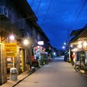
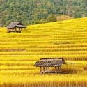
Khong Chiam the Mun river, the biggest river of the Khorat Plateau, joins the Mekong, which forms the north-eastern boundary of Thailand with Laos. It is called Maenam Song Sior the Mun River alluvium because the brown water from Mekong River is mixed with blue water from Mun River. It is located about 84 km. from Ubon Ratchathani City centre.
The area where the borders of the three countries Thailand, Laos and Cambodia meet is promoted as the Emerald Triangle, in contrast to the Golden Triangle in the north of Thailand. The Emerald refers to the large intact monsoon forests there.
Another natural place is namtok Saeng Chan. This waterfall is 1 km. from Thung Na Muang Waterfall.
Ubon Ratchathani also boasts the following national parks:
Phu Chong Na Yoi National Park covers an area of 687 km² over mountainous areas in the province. The park is where Thailand borders Laos and Cambodia. Visitors are recommended to take hiking trails which lead on to the high plateau. The best view of this is the cliffs at Pha Pheung. The interesting attractions include: the 40 m Bak tew Yai Waterfall, which is located 4 km from the park office.
Kaeng Tana National Park is in Khong Chiam District. It can be reached on two routes. The first route is by taking Highway No.2222 where visitors can see a beautiful view of Kaeng Tana, an island in the Mun River. Another way, visitors can go this way by taking the route to the National Park Office along Highway No.217.
Pha Taem National Park[1] covers an area of 140 km². Plateaus and hills dominate the park landscape. The sheer cliffs here are a result of earthquakes. The interesting places in the national park are Pha Taem and Pha Kham. On the cliffs surface are numerous prehistoric cave paintings from 3,000-4,000 years ago. These paintings depict scenes of fishing, rice farming, figures of people, animals, hands and geometric designs that show the way of life during the pre-historic time and reflect the ancient lifestyle of the people who lived there.

credit:http://en.wikipedia.org


